Exploreyour|
LikeNeverBefore
Ride, run, walk, or hike — visualise every street you've explored, know your coverage percentage, find all the roads you've not covered it and create timeline videos of your outdoor activities.
Create Stunning Timeline Video
Visualise how you progressively explored each neighborhood, street by street, in a captivating time-lapse format.
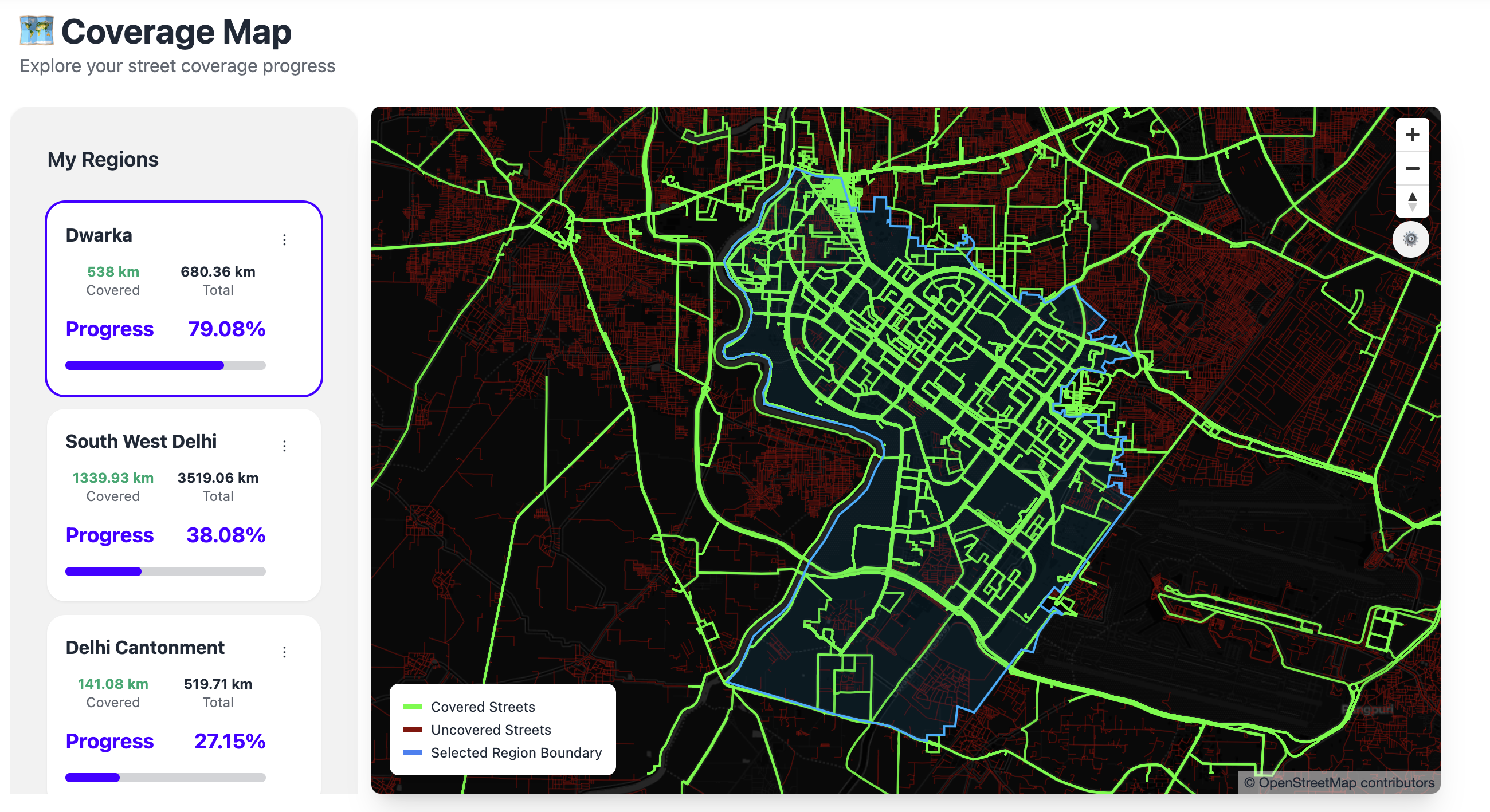
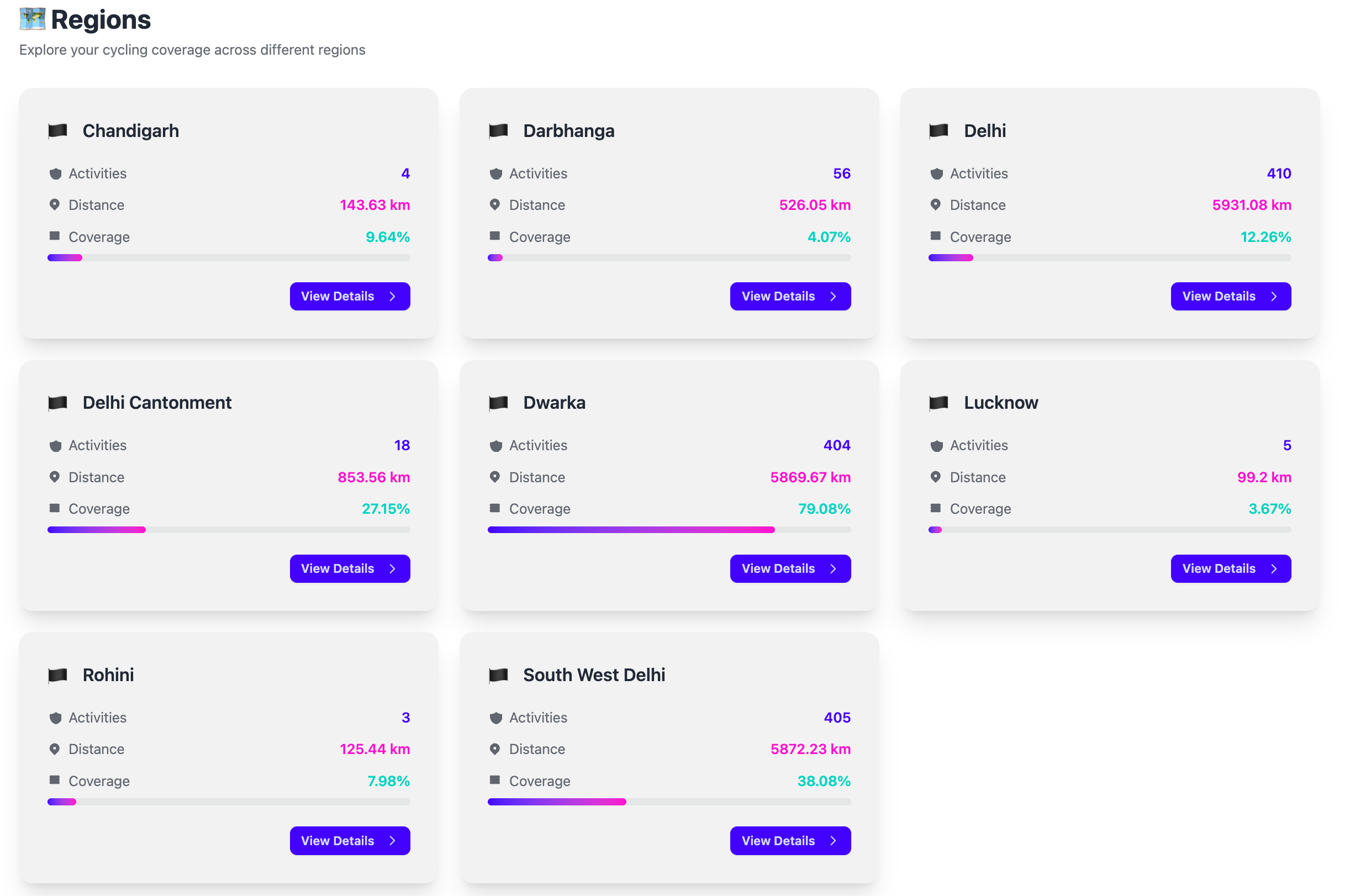
Coverage Percentage
Get coverage percentage for your region - what percentage of streets have you covered till now. See how each activity increase that number!
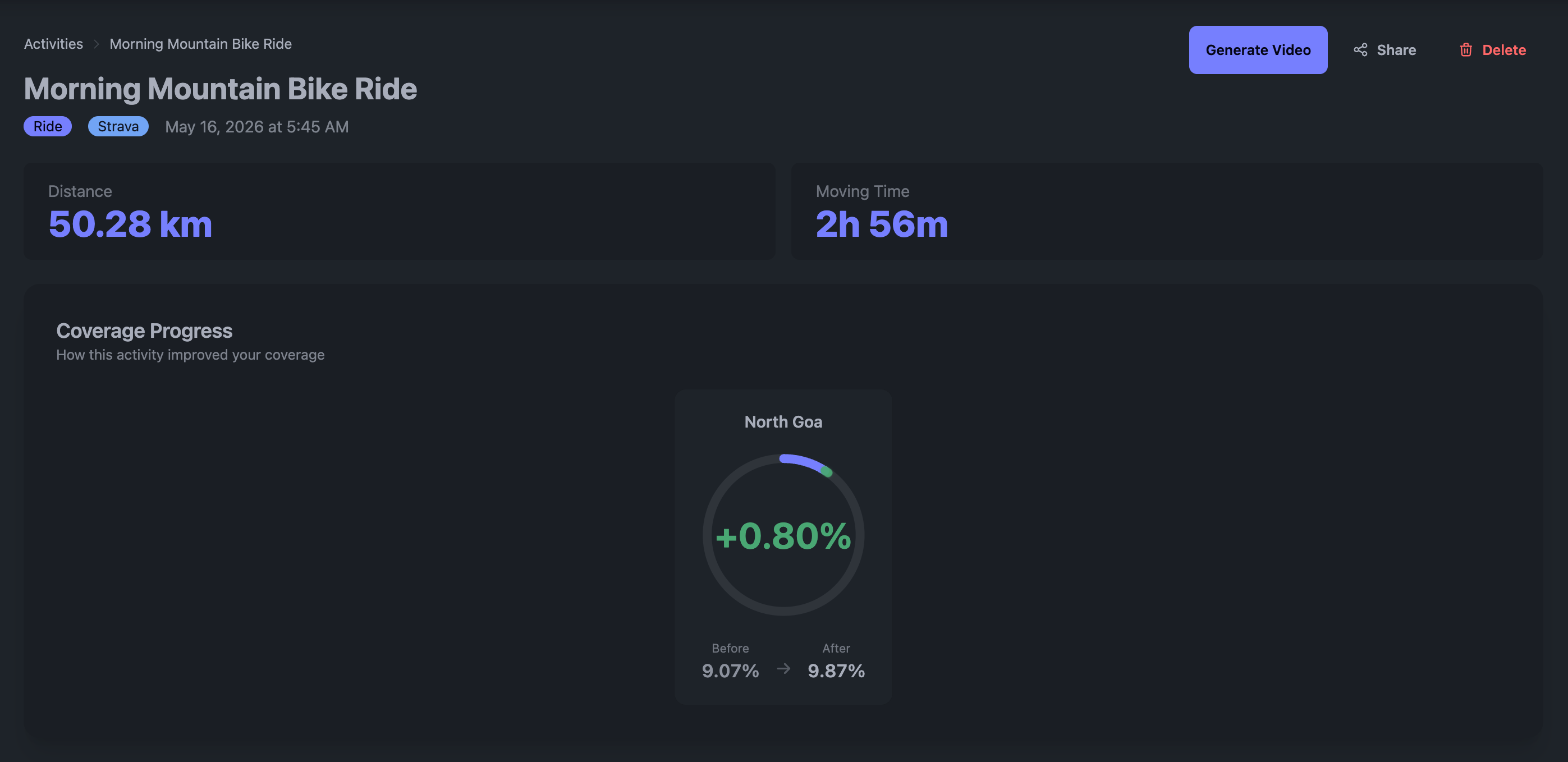
Activity Level Coverage Progress
Get coverage progress details for every activity. Push yourself to cover the unexplored areas to get the perfect score.
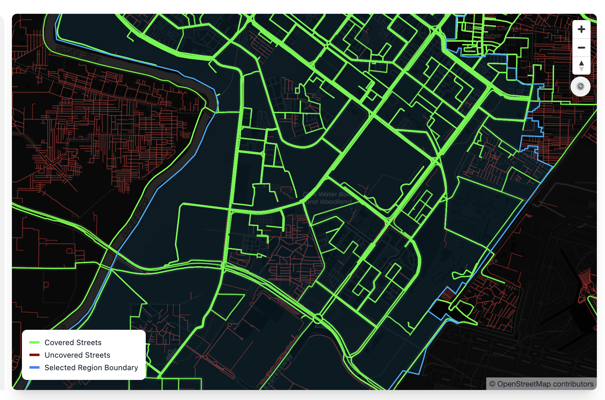
Interactive Coverage Maps
Pinpoint exactly which streets you've covered and which one is waiting for you to explore.
Multi Region Support
Interactive Coverage Maps and Coverage Percentage will be available for all the regions where you have activities.
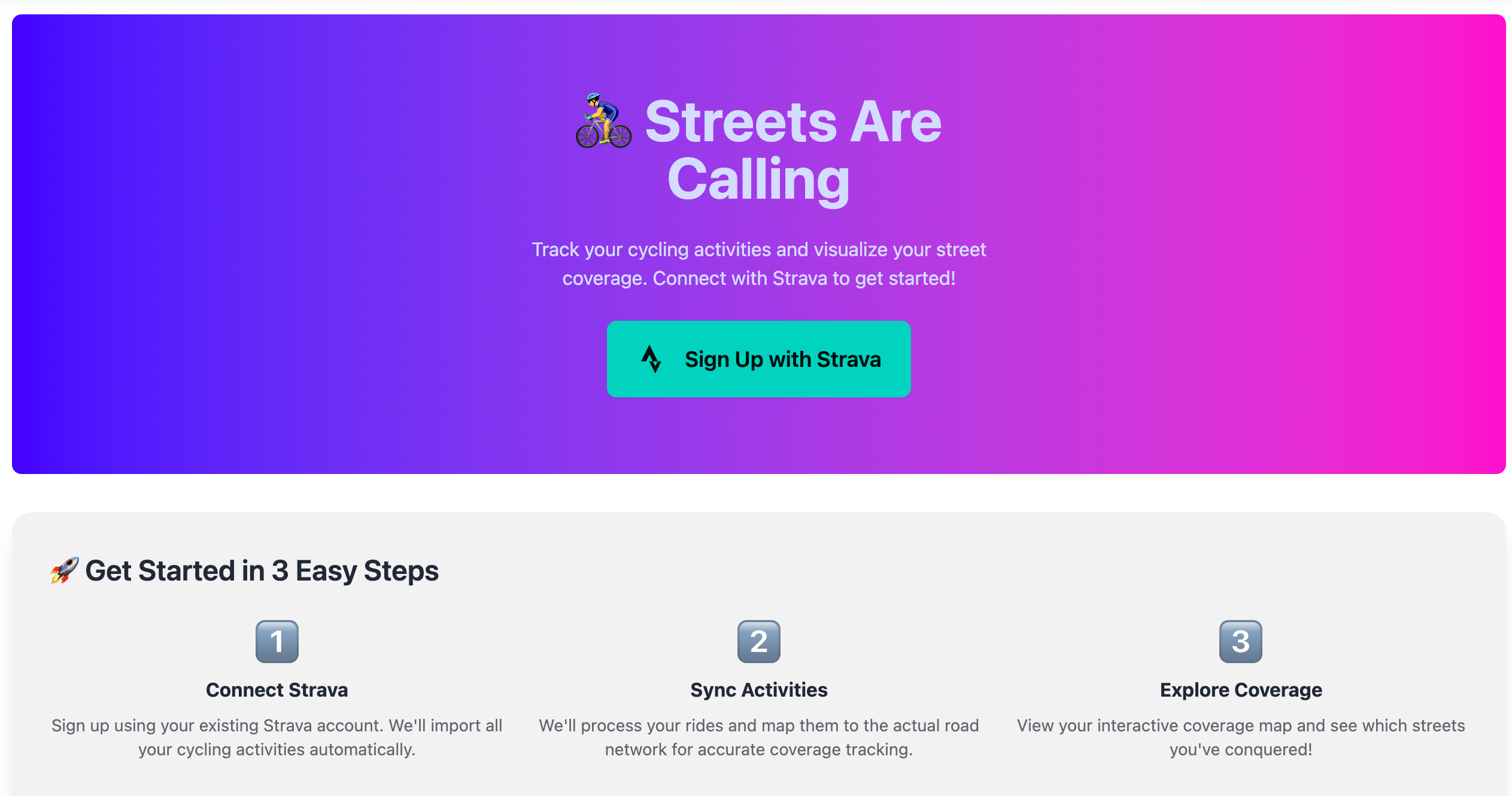
Seamless Strava Integration
Connect with your existing Strava account. All your activities sync automatically - no manual uploads or data entry required.
Everything You Need to Explore More
From coverage maps to stunning videos, experience how StreetsAreCalling transforms your activity data into beautiful visualizations and insights.
Join the Waitlist
Be the first to experience the future of local exploration